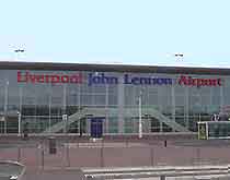
Liverpool John Lennon Airport (LPL)
Driving Directions / Travel by Car
(Liverpool, Merseyside, England, UK)
Liverpool John Lennon International Airport (LPL) provides air travel for a variety of cities in the north-west of England. The airport is situated only 11 km / 7 miles from the centre of Liverpool, with the M56 motorway providing the most convenient access.
Located on the south-western side of the city, Liverpool Airport is close to Halewood and Garston. The grounds are bordered on their northern perimeter by the A562, which is also known as Speke Boulevard.
Directions to Liverpool John Lennon International Airport (LPL) from the north of the city:
- The airport is well served by local roads and the regional motorway network
- Take the M6 southbound to Junction 21A, where you will join the M62. Follow the M62 until exiting at Junction 6 onto the A5300, which leads to the A561
- From here, follow signs for the airport, which is located off Speke Hall Avenue
Directions to Liverpool John Lennon International Airport (LPL) from the south of the city:
- Head north along the M6 to Junction 20, where you can join the M56
- Follow the M56 to Junction 12 before joining the A557 / A562 which merges with the A561
- From here, follow signs for the airport, which is located off Speke Hall Avenue
Directions to Liverpool John Lennon International Airport (LPL) from the east of the city:
- Head north along the M6 to Junction 20, from where you can join the M56
- Follow the M56 to Junction 12 before joining the A557 / A562 which merges with the A561
- From here, follow signs for the airport, which is located off Speke Hall Avenue
The M6 and M56 motorways are busy routes, especially during rush hours, hence travellers are advised to plan their travel schedules around the possibility of delays.
Liverpool John Lennon Airport (LPL): Virtual Google Maps
